Working with Maps
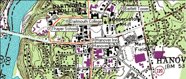
There are four main types of maps in ExpertGPS: Street Maps, Topo Maps, Aerial Photo Maps, and Scanned Maps. You can view your GPS data on more than one map at the same time, and even view Elevation Profiles and Lists to cross-reference your data.

Showing or Hiding a Map
Commands to show or hide a map are on the .
Map Tools
The tools on the Map Tools toolbar let you quickly move around the map, draw on the map, and select and edit items on the map.
Moving the Map
Use the ![]() Move Map tool to grab and drag the map to a new location. Click
the
Move Map tool to grab and drag the map to a new location. Click
the ![]() Recenter Map tool on the map to recenter the map at that location. You can also
move the map using the cursor keys,
the keys on the numeric keypad.
Recenter Map tool on the map to recenter the map at that location. You can also
move the map using the cursor keys,
the keys on the numeric keypad.
Changing the Map Scale (Zooming)
Use the ![]() Zoom tool to zoom in and view the map in more detail.
To zoom out, hold down the Alt key. The cursor will change to
Zoom tool to zoom in and view the map in more detail.
To zoom out, hold down the Alt key. The cursor will change to ![]()
You can also zoom in and out by pressing the + and - keys.
To change the map scale to a specific value, use the Zoom to Scale command.
Drawing and Creating New Items
Use the ![]() Waypoint Tool to create a new waypoint on the map.
Waypoint Tool to create a new waypoint on the map.
Use the ![]() Route Tool to join waypoints into a route.
Route Tool to join waypoints into a route.
Use the ![]() Track Tool to draw a tracklog on the map.
Track Tool to draw a tracklog on the map.
Use the ![]() Shape Tool to draw a shape on the map.
Shape Tool to draw a shape on the map.
Use the ![]() Note Tool to add a note to the map.
Note Tool to add a note to the map.
Selecting and Moving Items on the Map
Use the ![]() Select tool to select items on
the map. Selected items can be moved to a new location using
the
Select tool to select items on
the map. Selected items can be moved to a new location using
the ![]() Move Selected tool.
Move Selected tool.
Printing
To customize how the map will be printed, click on the . To see how a map will look when printed, click the button to open the Print Preview window.
© 1998-2025 TopoGrafix – 24 Kirkland Dr, Stow, MA – Email: support@expertgps.com


