Go to Menu
The Go menu contains commands to recenter the map.
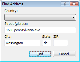
- Go to Address
-
Converts an address into geographic coordinates, and creates a new waypoint at that location.

- Go to Active Point
- Recenters the map on the Active Point.
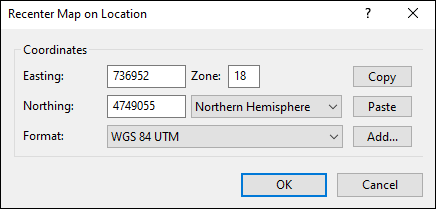
- Go to Coordinates
-
Recenters the map on the coordinates you enter.

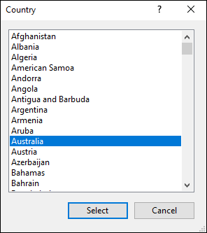
- Go to Country
-
Recenters the map on the country you select, at the approximate location of the capital city.

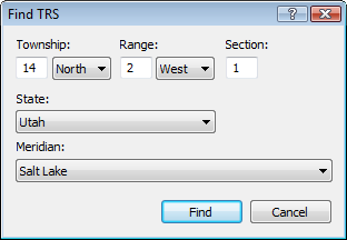
- Go to Township, Range, Section
-
Recenters the map on a township, section, and range in the US Public Land Survey System (PLSS).

- View Online
- View online maps and related resources for the selected item.
- View in Google Earth
- View the data on the map or in the list in Google Earth.
- See the View From Here in Google Earth
- See the panorama from your favorite mountain peak in Google Earth, or visualize the view from any point along your intended trail.
- View in List
- View the selected items in the List view on the left side of the screen.
- View on Map
- View the selected items on the Map.
- Go to the Start Point of the Selected Track
- View the start of the selected track on the Map.
- Go to the End Point of the Selected Track
- View the end of the selected track on the Map.
- Add to Favorites
- Adds the selected object to the Favorites sub-menu, which allows you to quickly recenter the map on your favorite locations.
- Organize Favorites
- Opens the Favorites folder.
- Favorites
- Recenters the map on the saved location.
Related Topics
ExpertGPS works with hundreds of GPS receivers, including all
Garmin Drive,
nüvi,
eTrex,
Colorado,
Dakota,
echoMAP,
GPSMAP,
Edge,
Forerunner,
Montana,
Oregon, and
Rino models,
Magellan eXplorist GPS receivers, and
Lowrance HDS,
Elite, and
HOOK GPS chartplotters and fishfinders.
Download ExpertGPS
Find your GPS on the ExpertGPS compatibility list.
© 1998-2025 TopoGrafix – 24 Kirkland Dr, Stow, MA – Email: support@expertgps.com


