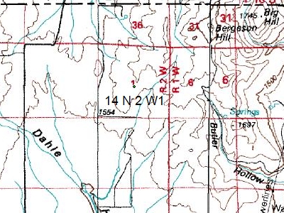
A long-standing feature request from ExpertGPS Pro users in the Western United States has been support for Public Land Survey System (PLSS) coordinates. For many of these users, locating and mapping parcels by township, range, and section (TRS) is a frequent task. While online TRS to lat/lon converters exist, having this capability built into ExpertGPS was their ultimate goal.

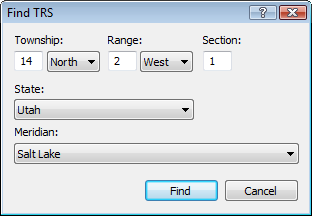
Tim Osborn pointed me to a TRS converter written in Fortran, and I’ve been working on integrating it into ExpertGPS Pro. The November, 2008 release of ExpertGPS Pro will feature a new Go to TRS command on the Go menu. Simply select your state and meridian, and enter the Township, Range, and Section, and ExpertGPS will recenter the map on that location and create a waypoint marking the section. Locating a parcel is now as easy as locating a street address in ExpertGPS.
The coordinate display readout in the lower-right corner of the main ExpertGPS Pro window will now display TRS coordinates in addition to lat/lon, UTM, or state plane. There is no setting to turn this on or off – if TRS coordinates are available for that location in your state, they will automatically be displayed.
Now the bad news: the TRS – lat/lon conversion is only available for these 17 Western states: AR AZ CA CO ID KS MT ND NE NM NV OK OR SD UT WA WY. Locations are approximate – the Go to TRS command will get you to the correct section, but if you need to locate the exact section corners, you’ll need to do a bit more work. Luckily these are usually shown on the topo map view, or you can download TRS shapefile data from BLM with the section boundaries.


ExpertGPS can display TRS coordinates and convert between lat/lon, UTM, and PLSS / TRS coordinates. These are the states that have TRS / PLSS support in ExpertGPS:
Arizona, Arkansas, California, Colorado, Idaho, Kansas, Montana, North Dakota, Nebraska, New Mexico, Nevada, Oklahoma, Oregon, South Dakota, Utah, Washington, Wyoming.
Johnnie wrote:
> I did not see Mississippi as a state listed. Do you have information for Mississippi?
ExpertGPS Pro doesn’t have built-in PLSS/TRS data for Mississippi, but you can overlay a GIS shapefile containing section corners from this Web site:
https://navigator.blm.gov/home
BLM Township, Range, Section (TRS) / PLSS Data is available for the following states. Use ExpertGPS Pro to overlay these shapefiles on your maps.
Alaska, Arizona, Alabama, Arkansas, California, Colorado, Florida, Georgia, Iowa, Idaho, Illinois, Indiana, Kansas, Kentucky, Louisiana, Michigan, Minnesota, Mississippi, Montana, North Dakota, Nebraska, New Mexico, Nevada, Ohio, Oklahoma, Oregon, Pennsylvania, South Dakota, Tennessee, Texas, Utah, Washington, Wisconsin, West Virginia, Wyoming
Hi,
Found this site trying to find out if the section corner posts have GPS coors availible online. The reason is that I have a mining claim boundary that is a section boundary and on the USGS paper map and the Geolocator is is one place, and on Google and MapTech it is about 300 feet to the West of USGS/GeoLocator spot as the topo shows two ravines on either side of the border. Thus Topo wise I can tell where both boundaries are clearly, the question is which of two choices is right.
So came up with the idea is I can find out what the GPS coors of the two Section Corners are, I can average the Longitude and be very accurate on border as I do have a GPS.
Is such info is availible on Corners without risking my life on a cliff trying to find them (had a close call already)?
It is the boundary of Section 17 and 18 as it intersects the Middle Fork of the Yuba River in Nevada County CA about
39.42806, -120.88667
I have a Garmin Etrex
Thanks if you can help, Dana
Any idea when Virginia maybe added ?
Unfortunately, the author of the PLSS/TRS component that ExpertGPS Pro uses will not be adding any new states or meridians.