Monica writes:
![]() I was wondering about a state correction for NAD 83 in New Mexico. I am not from here, but have an airphoto that I am working with in this specific system. My GPS unit does not have this grid installed. Would you suggest that I purchase a different GPS unit, or should I have this particular map converted? Are all maps likely going to be in this “State specific” grid system?
I was wondering about a state correction for NAD 83 in New Mexico. I am not from here, but have an airphoto that I am working with in this specific system. My GPS unit does not have this grid installed. Would you suggest that I purchase a different GPS unit, or should I have this particular map converted? Are all maps likely going to be in this “State specific” grid system?![]()

You’re not going to find a consumer-grade GPS receiver that supports New Mexico state plane coordinates, or any of the other US state plane coordinate systems. Garmin and Magellan simply don’t include these professional coordinate systems on their consumer-grade GPS receivers.
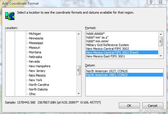
The easiest way to convert NM SPCS to something your GPS can use (lat/lon, or UTM) is to use mapping software like ExpertGPS Pro. ExpertGPS will allow you to work with New Mexico state plane coordinates and calibrate your airphoto using state plane coordinates. You can then switch the coordinate format in ExpertGPS to latitude/longitude or UTM, to match your GPS. This makes it very easy to convert between state plane and UTM or latitude/longitude GPS coordinates.
Even when you’re viewing a map or aerial orthophoto projected using the New Mexico state plane coordinate system, ExpertGPS Pro will be able to convert your GPS data (waypoints, routes, and tracks) back and forth between NM SPCS NAD83 and whatever format your GPS uses (lat/lon NAD27, UTM WGS84, etc) so that your data always displays in the correct location.
To get started with ExpertGPS, download the 30-day trial and follow these instructions for calibrating and geo-referencing your NM NAD83 airphoto.


