Paul R. asks:
![]() For a project, I am using a Google Maps API application to create cycling routes. I am creating the routes in the Google Maps API application because the ultimate target application also runs on the Google Maps API. I have very limited export options but I can export tracks in kml format. I can import these kml files into ExpertGPS and I can then export from ExpertGPS the files I need for my application. One of the file types that I export from ExpertGPS for use in my application is a text-delimited tracking file. My problem is that I would like to have elevations in the exported tab-delimited tracking file, but at the moment I can’t figure out how to do that.
For a project, I am using a Google Maps API application to create cycling routes. I am creating the routes in the Google Maps API application because the ultimate target application also runs on the Google Maps API. I have very limited export options but I can export tracks in kml format. I can import these kml files into ExpertGPS and I can then export from ExpertGPS the files I need for my application. One of the file types that I export from ExpertGPS for use in my application is a text-delimited tracking file. My problem is that I would like to have elevations in the exported tab-delimited tracking file, but at the moment I can’t figure out how to do that.![]()

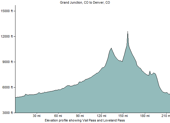
The July 2009 release of ExpertGPS features a new tool to calculate the elevation of any location in the world, and add that elevation data to any waypoint, route, or track. In the past, when you drew a track on the map in ExpertGPS, or imported driving directions or trails from Google Earth or another 2D mapping source, you wouldn’t have elevation data available. Now, using the Get Elevation command on the Tools menu in ExpertGPS, you can add elevation to anything. Simply select the waypoints, routes, or tracks on the map, and click Get Elevation. ExpertGPS will determine the elevation for each point, using the best-available data from the US Geological Survey and NASA’s Space Shuttle Radar Tomography Mission (SRTM). In a few seconds, you’ll have elevation data, and you can use the Show Elevation Profile command on the Track menu to plot the elevation at every point along your hike, ride, or drive.


Thanks, Great feature.
I am currently trying to determine the reference of the SRTM data. Is it MSL (Mean Sea Level), or HAE (Height Above Elipsoid)?
It doesn’t seem to match Google Earth (assumed to be MSL).
Thanks -
SRTM elevations are referenced to Mean Sea Level