Calibration Point 1 Tool
The Calibration Point 1 Tool sets the location of the first calibration point on a Scanned Map.
To select the Calibration Point 1 Tool, do the following:
- View a scanned map.
- Then, do one of the following:
- On the , click .
- Press 1.
- Click the button on the Map toolbar.
- The cursor will change to

Quick Reference
| Action | Result |
| Click | Enter coordinates for the first calibration point |
| Hold down the Shift key and click | Select a waypoint as the first calibration point |
| Right-click | Show the Shortcut Menu |
Setting the first calibration point by entering coordinates
To enter the coordinates of the first calibration point, do the following:
- Position the Calibration Point 1 Tool over a point on the map where you know the correct coordinates. (a grid line intersection, for example)
- Click.
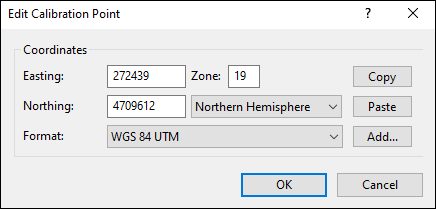
- The Edit Calibration Point dialog will appear. Enter the coordinates, and click .

Setting the first calibration point by selecting a waypoint
To select a waypoint as the first calibration point, do the following:
- Position the Calibration Point 1 Tool over a feature on the map which corresponds to a waypoint in the file. (a mountain summit, the trailhead parking lot)
- Hold down the Shift key.
- Click.
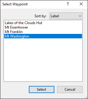
- The Select Waypoint dialog will appear. Select the corresponding waypoint, and click .

ExpertGPS works with hundreds of GPS receivers, including all
Garmin Drive,
nüvi,
eTrex,
Colorado,
Dakota,
echoMAP,
GPSMAP,
Edge,
Forerunner,
Montana,
Oregon, and
Rino models,
Magellan eXplorist GPS receivers, and
Lowrance HDS,
Elite, and
HOOK GPS chartplotters and fishfinders.
Download ExpertGPS
Find your GPS on the ExpertGPS compatibility list.
© 1998-2025 TopoGrafix – 24 Kirkland Dr, Stow, MA – Email: support@expertgps.com


