Automatically Add USGS Topo Map Command
ExpertGPS has a seamless topo basemap, which includes collarless USGS topo maps for the entire United States. But there are times when you may want to view your data over a specific, historical USGS topo map. The Automatically Add USGS Topo Map command is perfect for those doing research on abandoned railroad lines, or for anyone interested in how the maps of their area have evolved over the decades.
To add a pre-calibrated, high-resolution scan of a USGS topographical map to your Scanned Map Library in ExpertGPS, first recenter the map to your area of interest. Then, click on the , under .
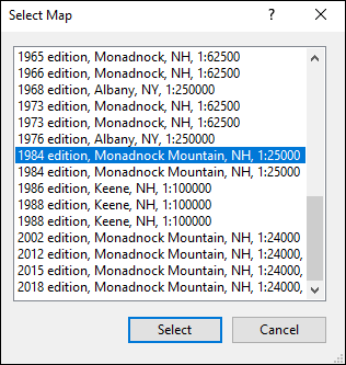
The Select Map dialog will appear. Select the edition of the USGS topo map you want to add to ExpertGPS. ExpertGPS will automatically download and calibrate the selected map for you to use.
© 1998-2026 TopoGrafix – 24 Kirkland Dr, Stow, MA – Email: support@expertgps.com