Convert Jordan Coordinates in a Single Click
Using ExpertGPS as a Jordanian GPS, GIS, and CAD Coordinate Converter
With just a single click, you can do Jordanian datum conversions or re-project entire files of coordinate data between Jordanian coordinate formats. ExpertGPS supports all of the coordinate formats used in Jordan, including ED 1950 Jordan TM, UTM, and latitude and longitude.
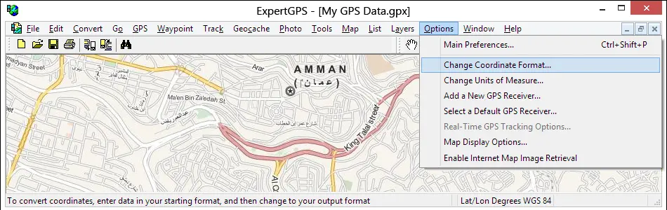
You can convert your GPS, GIS, or CAD data to any of these formats by bringing it into ExpertGPS and then selecting Change Coordinate Format... on the Options menu in ExpertGPS. Your data is instantly reprojected to the new datum and coordinate format.
Even if your GPS doesn't support the coordinate grid format you use for a project at work, you can use ExpertGPS to seamlessly move your data between your GPS and your workstation, reprojecting the data on-the-fly to match the coordinate system you use in AutoCAD or ArcGIS. ExpertGPS also creates Excel CSV and Google Earth KML files so you can create reports or view your coordinate data over high-resolution aerial imagery and GPS maps of Jordan.
ExpertGPS Converts Between Any of These Jordanian Coordinate Formats:
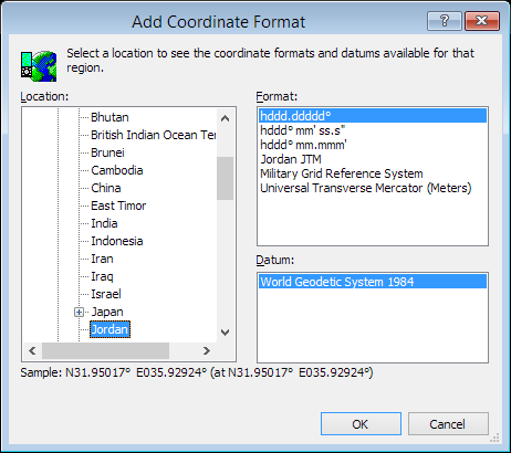
- hddd.ddddd° (Lat/Lon Degrees)
- hddd° mm.mmm' (Lat/Lon Degrees & Minutes)
- hddd° mm' ss.s" (Lat/Lon Deg. Min. Sec.)
- Universal Transverse Mercator (UTM)
- Military Grid Reference System (MGRS)
- ED 1950 Jordan TM - EPSG 3066
ExpertGPS Reprojects Your Data Between Any of These Datums:
- World Geodetic System 1984 (WGS 84) - EPSG 4326
- World Geodetic System 1972 (WGS 72) - EPSG 4322
- European 1950, Mean (7 Param) (European 1950) - EPSG 4230
New features were added to ExpertGPS on April 3, 2025
ExpertGPS runs on Windows 11 and Windows 10.
© 1998-2025 TopoGrafix – 24 Kirkland Dr, Stow, MA – Email: support@expertgps.com