Steve K. asks:
![]() I’m using your trial software to see if it’s right for me. I’m an architect and I need the ability to export to AutoCAD. As an experiment, I drew the metes and bounds of a particular parcel over the aerial photo map that loads automatically in the trial version. I did this by establishing waypoints and projecting each one to the next in series. Then I connected them all as a route, and then converted the route to a shape. Finally, I exported the shapes to .dxf, but when I open the file in AutoCAD, the shape is completely distorted. I’m not sure what’s causing this or how to remedy it.
I’m using your trial software to see if it’s right for me. I’m an architect and I need the ability to export to AutoCAD. As an experiment, I drew the metes and bounds of a particular parcel over the aerial photo map that loads automatically in the trial version. I did this by establishing waypoints and projecting each one to the next in series. Then I connected them all as a route, and then converted the route to a shape. Finally, I exported the shapes to .dxf, but when I open the file in AutoCAD, the shape is completely distorted. I’m not sure what’s causing this or how to remedy it.![]()
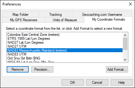
The DXF drawings you export from ExpertGPS Pro use the coordinate format and datum you’ve selected within the program. Most likely, what’s happening is that you’ve got the coordinate format in ExpertGPS set to latitude and longitude, and so you’re seeing distortion when your CAD software tries to display lat/lon data as X,Y eastings and northings. There’s an easy fix, which you only have to do once: select a new coordinate format in ExpertGPS prior to exporting. You can set ExpertGPS to display coordinates in US State Plane coordinates, UTM, or pretty much any national grid coordinate system.